
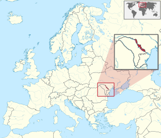
Dosya:Transnistria in Europe (zoomed).svg

Bu SVG dosyasının PNG önizlemesinin boyutu: 701 × 599 piksel. Diğer çözünürlükler: 281 × 240 piksel | 561 × 480 piksel | 898 × 768 piksel | 1.198 × 1.024 piksel | 2.395 × 2.048 piksel | 1.401 × 1.198 piksel.
Tam çözünürlük (SVG dosyası, sözde 1.401 × 1.198 piksel, dosya boyutu: 2,67 MB)
Bu dosya Wikimedia Commons'ta bulunmaktadır. Dosyanın açıklaması aşağıda gösterilmiştir. Commons, serbest/özgür telifli medya dosyalarının bulundurulduğu depodur. Siz de yardım edebilirsiniz. |
Özet
.svg)
.svg)
.svg)
.svg)
.svg)
.svg)
.svg)

-en.svg)

.svg)
.svg)
.svg)

_(US48).svg)
_(small_islands_magnified)_(-mini_map_-rivers).svg)
.svg)
_(extra_close)_(US48).svg)
.svg)
_(zoom).svg)

.svg)


_(UNMIK).svg)
.svg)
_(disputed_hatched).svg)
_(claimed_and_disputed_hatched).svg)
.svg)
.svg)
_(%2Ball_claims_hatched).svg)

.svg)
_(shade).svg)
_(shade)_(special_marker).svg)
_(-mini_map).svg)
_(-mini_map).svg)
_(-mini_map).svg)


.svg)

.svg)
.svg)
Lisanslama
Ben, bu işin telif sahibi, burada işi aşağıdaki lisans altında yayımlıyorum:
Bu dosya, Creative Commons Atıf-Benzer Paylaşım 3.0 Taşınmamış lisansı ile lisanslanmıştır
- Şu seçeneklerde özgürsünüz:
- paylaşım – eser paylaşımı, dağıtımı ve iletimi
- içeriği değiştirip uyarlama – eser adaptasyonu
- Aşağıdaki koşullar geçerli olacaktır:
- atıf – Esere yazar veya lisans sahibi tarafından belirtilen (ancak sizi ya da eseri kullanımınızı desteklediklerini ileri sürmeyecek bir) şekilde atıfta bulunmalısınız.
- benzer paylaşım – Maddeyi yeniden düzenler, dönüştürür veya inşa ederseniz, katkılarınızı özgünüyle aynı veya uyumlu lisans altında dağıtmanız gerekir.

|
Yani, eğer Wikipedia veya Commons dışında kullanılan bir "Wikimedia Commons", bu medya atrribute olur. Yayınlar (örneğin, kitaplar, gazeteler, bloglar, web siteleri, vb) kullanmak için buraya Aşağıdaki satırları yerleştirin lütfen.
{{published|author= |date= |url= |title= |org= }}
Lütfen eksik bilgileri doldurun. (Örnek). Lisans koşulları hala geçerli yukarıda verilmiştir. (Bu, Google tarafından otomatik bir çeviri denemesi. Lütfen bu metni geliştirmeye yardımcı olur. Sonra metin artar bu satırı kaldırın.)
|
.svg)
Dosya geçmişi
Dosyanın herhangi bir zamandaki hâli için ilgili tarih/saat kısmına tıklayın.
| Tarih/Saat | Küçük resim | Boyutlar | Kullanıcı | Yorum | |
|---|---|---|---|---|---|
| güncel | 20.18, 2 Ocak 2025 | | 1.401 × 1.198 (2,67 MB) | Mastersun25 | update Karabakh |
| 09.39, 25 Ağustos 2014 |  | 1.401 × 1.198 (2,67 MB) | Nicolay Sidorov | fix border (+Bendery) | |
| 09.39, 9 Ağustos 2011 |  | 1.401 × 1.198 (4,07 MB) | TUBS | {{Information |Description={{de|Lage von XY (siehe Dateiname) in Europa.}} {{en|Location of XY (see filename) in Europe.}} |Source={{own}}{{Adobe Illustrator}}{{Commonist}}{{AttribSVG|Europe laea location map.svg|Alexrk2}}{{ |
Dosya kullanımı
Bu görüntü dosyasına bağlantısı olan sayfalar:
Küresel dosya kullanımı
Aşağıdaki diğer vikiler bu dosyayı kullanmaktadır:
- als.wikipedia.org üzerinde kullanımı
- arz.wikipedia.org üzerinde kullanımı
- ast.wikipedia.org üzerinde kullanımı
- az.wikipedia.org üzerinde kullanımı
- ba.wikipedia.org üzerinde kullanımı
- bcl.wikipedia.org üzerinde kullanımı
- be.wikipedia.org üzerinde kullanımı
- bew.wikipedia.org üzerinde kullanımı
- bn.wikipedia.org üzerinde kullanımı
- bn.wikivoyage.org üzerinde kullanımı
- ca.wikipedia.org üzerinde kullanımı
- cdo.wikipedia.org üzerinde kullanımı
- ce.wikipedia.org üzerinde kullanımı
- cs.wikipedia.org üzerinde kullanımı
- cu.wikipedia.org üzerinde kullanımı
- cy.wikipedia.org üzerinde kullanımı
- de.wikipedia.org üzerinde kullanımı
- diq.wikipedia.org üzerinde kullanımı
- el.wikipedia.org üzerinde kullanımı
- en.wikipedia.org üzerinde kullanımı
- en.wikivoyage.org üzerinde kullanımı
- es.wikipedia.org üzerinde kullanımı
- et.wikipedia.org üzerinde kullanımı
- fa.wikipedia.org üzerinde kullanımı
- fi.wikipedia.org üzerinde kullanımı
- fr.wiktionary.org üzerinde kullanımı
- gl.wikipedia.org üzerinde kullanımı
- hak.wikipedia.org üzerinde kullanımı
- he.wikipedia.org üzerinde kullanımı
- hi.wikipedia.org üzerinde kullanımı
- hsb.wikipedia.org üzerinde kullanımı
- ht.wikipedia.org üzerinde kullanımı
- hu.wikipedia.org üzerinde kullanımı
- hy.wikipedia.org üzerinde kullanımı
- id.wikipedia.org üzerinde kullanımı
- incubator.wikimedia.org üzerinde kullanımı
- is.wikipedia.org üzerinde kullanımı
- it.wikipedia.org üzerinde kullanımı
Bu dosyanın daha fazla küresel kullanımını görüntüle.
.svg)
.svg)